HOUSES great & small
A Village that grew..... and grew
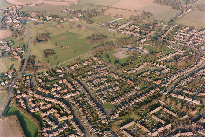
The key to understanding Mulbarton today is to look at the way the population has grown over the years....

In Domesday times (1086) the population was probably no more than 150. There would have been many fluctuations over the next 700 years (especially at the time of the Black Death which seems to have wiped out Kenningham), but during that time the population had grown to little more than three times that of Norman times. Census figurs show that from 1801 to 1951 the population stayed much the same - 582 people in 1841; 598 people in 1951. But since the 1950s, the population has grown by more than eight times!
Here is a brief summary of Mulbarton's growth:
- 150+ years - a small village of around 500 people on the New Buckenham Turnpike. Most lived in the area between the Church, World's End and Paddock Farm. There were small clusters of houses near the Tradesman's Arms; near Mulbarton Hall and the Old Rectory; and in the Rosery.
- 1920s & '30s - first Council Houses built in Long Lane, Cuckoofield Lane, Birchfield Lane and St Omer Close to re-house local people who were living in inadequate accommodation. This meant more people living south of the Common.
- 1950s - more Council Houses built in Cuckoofield Lane and Birchfield Lane for local people and some of those housed on the old Hethel USAAF airfield. The population rose slightly - with most newcomers south of the Common.
- 1960s - the planners allowed small 'infill' developments in the fields between the Common and the Council Houses in Cuckoofield Lane + some 'infill' and 'ribbon development' along The Rosery. The centre of population had shifted to south of the Common.
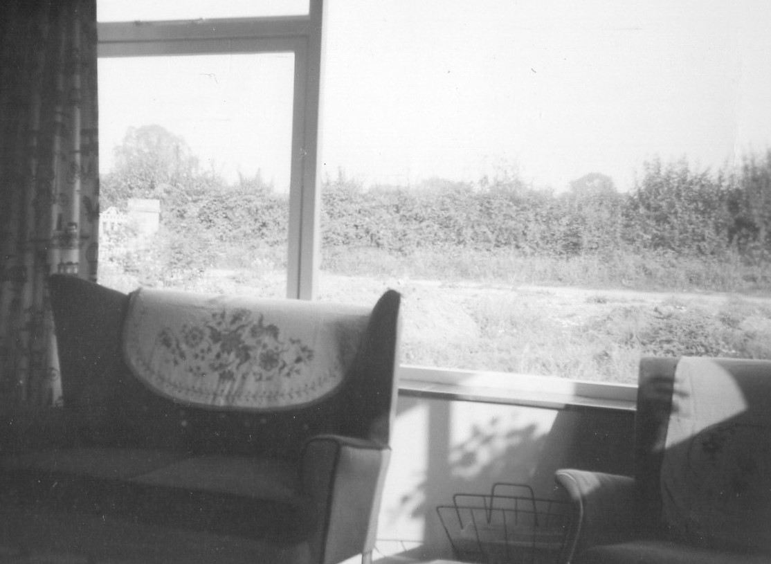
- The photos below show one of the first post-war houses in Long Lane, between the Hall Cottages and the Council Houses. Built in 1960, they were surrounded by fields: behind this house is the field that will become Rosery Close, and the line of trees that once divided it from Lakes Avenue. The view across Long Lane from the front window (right) shows fields that will become Bluebell Road and roads off in 15 years time!
- 1970s - the Norfolk Plan designates Mulbarton a village for development (along with Hethersett, Poringland and some villages north of the City). Major development companies buy up land to build large estates centred on Bluebell Road and Lark Rise + the Hanover Gardens complex and smaller developments on other pockets of land.
- 1980s & '90s - Development continues and the estate centred on Catmere Herne is built right up to the southern boundary of the parish.
- 2000 onwards - Mulberry Gardens built on land that had been designated for more Council housing in the 1970s but with changes in central government policy was sold for private development.
- 2015 - a new housing development, Oakleigh Park, began on land that had previously been outside the housing 'envelope' but building was allowed in response to Government policy to provide more housing land.
Now find out more about the houses of Mulbarton:

The North end of Mulbarton (including the 'Factory Houses' or Scott's Terrace)
West of the Common, by 'Carpenters'
Council Houses - 'Homes for Heroes'
Housing Estates - new houses in old fields


